
We’re spending two days at a quiet campground in Eikesdalen. This small community is about an hour from the nearest town with modern facilities. Its only access via a relatively new, narrow country road or the old mountain road known as the Aursjovegen, which is a time-consuming proposition of its own. It’s situated at the far end of a 30km long fjord-like lake; its only access used to be through a small local car ferry, which is still docked on the near end of the lake. Maybe they still bust it out from time to time for some recreational cruises. As it stands now, this country road has about 6km of tunnels — a real testament to how big infrastructure projects are not limited to the big city in Norway.
There were six huts so we didn’t have to tent camp. The notice on the entrance sign was something to the effect of “if the key is in the door, it’s available — please leave the money in the dropbox.” So we did for two days. That was the extent of our interaction with the campground officials.

During our non-travel day, we opted for a circle tour of the Aursjovegen. It climbs the valley and then meets another old road up on the plateau. Then we descend, eventually reconnecting to our valley from the fjord below. 90 miles total of driving, much of it single lane gravel with switchbacks. Good times!

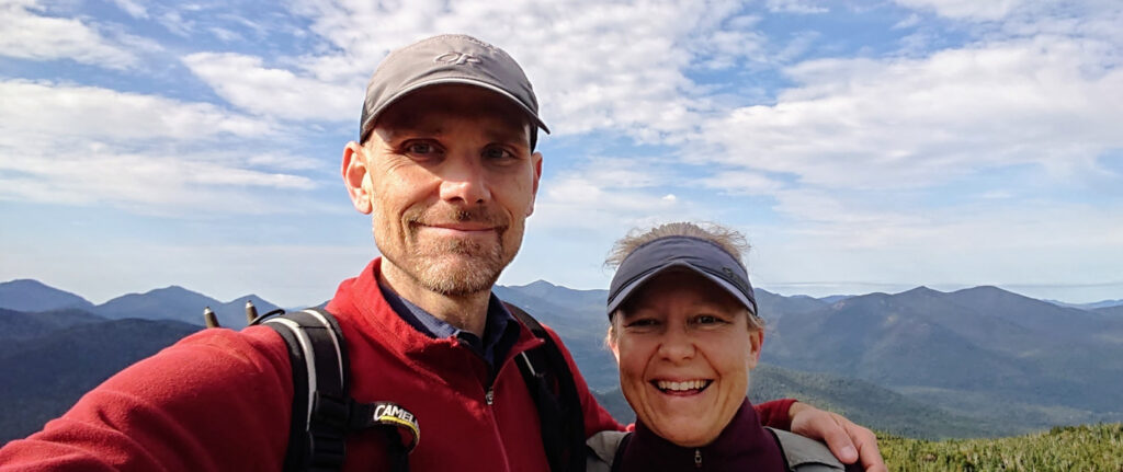
At the start of the day there was an automated toll of ~$7 (using an adorable little credit-card machine) for access to this stretch of road. We checked our maps there and fueled up our nerve juice, along with a crew of four older German travelers (not pictured). This group was working hard to communicate with us but (in a rare situation) there was little or no English so we had to resort to hand signals and facial expressions. I tried to convey that if we saw them go over the cliff, we’d be sure to call the authorities ASAP and would they mind doing the same? I think they got the message. We would end up leap-frogging them up the valley for the next few hours.
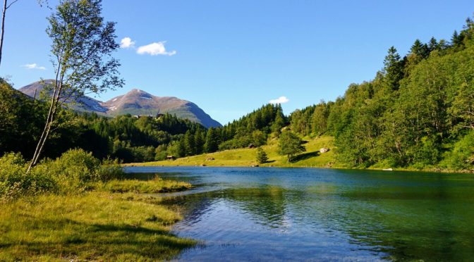
Here’s one of the first picturesque pulloffs, before we got all that high into the mountain. You can still see farms below, along with the river. In the far distance you can see the lake (Eiksdalsvatnet) peeking out.

Getting higher up, we twisted and turned and went through some disorienting C-shaped tunnels that we entered going east and exited heading west. Lots of precautionary tooting, because this was a two-way road with only one consistent lane of travel.

Once we reached the plateau, the landscape had changed dramatically. A lot more scrubby plants and less green. Patches of snow dotted the terrain.

Once we reached the top it was about cookie time. Coffee and cookie time, that is. Ben was feeling the strain of the driving — not what you’d call an easy go of it.

On the advice of Grethe, we had taken a thermos to bring hot water with us every morning. This let us do nice coffee breaks with the relatively decent instant coffee.
After our break we embarked on the new road and began our slow descent down the valley towards Sunndalsøra. We stopped for a quick-shot two hour hike and found our own place to chill out. It was a gorgeous day — perfect temperature for this sort of work.

A few strategic stops left us feeling… just right.

We dropped down the valley and hit up our favorite grocery store chain, the Bunnpris, for some food for the night. Then we headed back up to Eikesdalen and on the way we caught this picture of a bike.

There were actually dozens of these brightly painted bikes situated in various places along the way. We think they were promoting a bike event that was happening on the upcoming weekend.
When we got back we made some dinner and had some nearbeer. Then we (of course) headed out for another hike.


Then bed.
